Torotoro National Park
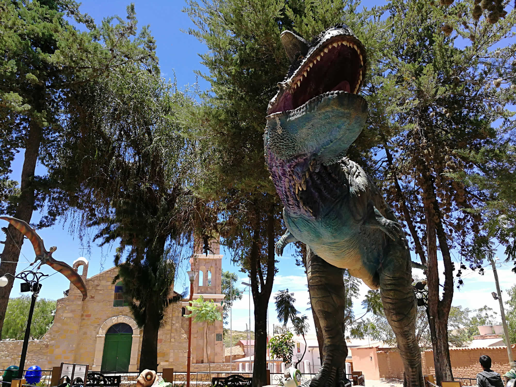
Torotoro, Land of Dinosaurs

If you are looking for the REAL Jurassic World, then Torotoro is the destination for you! The park is filled with fossils and ancient dinosaur tracks, revealed in the spectacular rock formations created by the folding of the Earth's crust!
-
Plan your trip to Torotoro, Bolivia


General Information
Creation:Torotoro National Park was created by D.S. 22269 on July 26, 1989
Area:Torotoro National Park covers 16570 hectares.
Altitude:1900 at 3700 m.s.n.m.
Population:About 4996 inhabitants. 27 Communities.
The Torotoro region contains monumental geological, geomorphological and speleological structures made up of stacks of strata that hold in their rocky memory the long history of the Earth and life, with fossils from the Paleozoic (Ordovician, Devonian, and Permian), the Mesozoic (Cretaceous) and the Cenozoic (Paleogene and Quaternary) eras.
In Torotoro you will also find evidence of the process of domestication of the mountains by the Andean people.
Torotoro is a complex matrix of ecosystems defined in an altitudinal gradient that ranges from 1900 to 3700 meters. This altitudinal gradient has almost 2000 meters of variation on a geographical scale of 166km2. These unique characteristics make this an area of great natural contrasts.
GEOLOGY
Well known for the dinosaur footprints, Torotoro keeps in its rocky memory many stories of the passing of dinosaurs through the area. The geology shows the complete record of a Cretaceous sea, whose carbonate beds constitute today part of the mountains of the Eastern Cordillera of the Andes.
The Torotoro mountains are structured tectonically in a gigantic syncline, forming an alley 10 km wide by 45 km long. The vertical flanks are formed by white carbonate layers of the Andean Cretaceous Sea. Overlying these layers in the calla valley, there are intensely reddish strata of the Paleogene and Quaternary deposits.
Originating on the coast of this ancient continent, layers of the Permian, and even the more ancient Devonian and Ordovician periods crop up today. In Torotoro there is the record of the history of the shore of oceans and seas that existed 500 million years ago.
The diversity of rocks and structures creates a true open-air geological museum with more than 80 sedimentary facies that are diversified between siliciclastic (conglomerates, sandstones and pelites), carbonaceous, evaporite, biogenic, and even rock intrusions. In addition, an enormous range of ductile and fragile structures are observed, in several scales (from centimeters to kilometers), from gigantic folds like the syncline, to parasitic folds, or enormous inverse and normal faults and, even more, the multiplicity of networks of fractures generating impressive fractal geometries.
PALEONTOLOGY
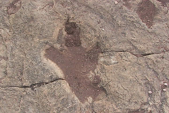
Torotoro contains fossils that cover great moments of the evolution of life that brings together the entire long Phanerozoic Eon, and the Paleozoic, Mesozoic and Cenozoic Eras. The best known are the dinosaur footprints of the Cretaceous Period. These footprints, more than 3,500 to date, are found in the whitish carbonate layers of the flanks and valley of the Torotoro syncline. They are observed in various configurations, sizes, and associations. In general, as trails of one or two individuals, but also in associations and, finally, the single-leg footprints, which include species of sauropods, theropods, ornithopods, and ankilosaurs. These tracks are present in eight successive stratigraphic floors, that is, one of the greatest historical and paleo-ecological successions of dinosaur footprints known in the paleontological records. These gigantic animals reached up to 30 tons each and they also made several deformations in the sedimentary layers below the floor where they wandered due to the small earthquakes they produced when walking.
At that time, the soil of what today is Torotoro was a very long and narrow epicontinental sea - called the Andean Cretaceous Sea -, which entered from the north from what is currently Venezuela and advanced to the south between the young pre-Andean elevations and the Brazilian Plateau.
A large part of these footprints were left on the shore of the carbonaceous swamps of this shallow sea of warm water, where a great diversity of species lived. Fossils are found from cyanophyceous bacteria that formed tapestries and stromatolites, to invertebrates (gastropods, bryozoans, bivalves, crinoids, corals), fish, crocodiles, turtles, among others. They are witnesses of a robust trophic chain of marine life which, in turn, had interactions with the trophic chain of continental life, including the gigantic dinosaurs that sought to feed there. And, the whole continental-marine complex can be seen as an impressive carpet of life, as impressive as the current coral reefs or the Amazon. All the sediments, tracks, remains of organisms and bio-accumulations of this sea and its shore are registered in the calcareous rocks of Torotoro. There are several marine environments that were recorded: from shallow to a little deeper, from shores of calm tides or from stormy events. In several locations, you can see that the level of this sea rose and fell, according to the climatic variations of the Cretaceous that took place on the western edge of the young continent of South America, and when the ancient supercontinent of Gondwana began to break apart completely.
In addition to fossils from the Cretaceous Period, in the overlying layers of intense reddish color, fossils of turtles and Paleogene crocodiles are found. These lived at a time when the dinos were already extinct and southern America was moving more and more to the west with the opening of the Atlantic. On the other hand, below the calcareous layers of the Cretaceous Andean Sea, are the fossils of the carbonate platforms of the Ordovician, Silurian and Permian periods. In each of these periods there were different associations of brachiopods, bryozoans and corals that represent the marine life that lived on the coast of Gondwana.
GEOMORPHOLOGY
Torotoro expresses a variety of geoforms that make this place a spectacular geomorphological atlas. The variety of carbonaceous, evaporite and siliciclastic rocks as well as the Andean tectonics of the last 25 million years and the geochemical and mechanical modeling processes explain the amazing diversity.
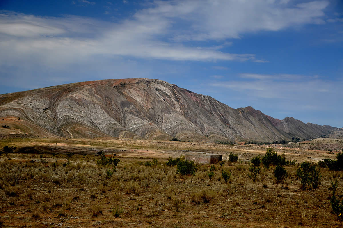
We start with a gigantic fold that is 45 km long and 10 km wide, called a syncline. This tectonic structure raised the whitish layers of the ancient Cretaceous Andean Sea floor, leaving them almost vertical, is the clear witness of the impressive orogenesis that formed the Eastern Andes.
There, on the edge of South America, the convergence with the Nazca Plate led to the shortening of the crust by means of large folds and faults. Thus, we can see the floors of the Cretaceous Sea constituting the flanks of Torotoro's syncline as if they were gigantic open books. The subsequent erosion of the flanks generated hills that are usually called by geologists "hogbacks". An extraordinary geomorphological design became possible: the aligned triangular hills resemble a sequence of teeth that, in homage to the Andean culture, are called "Q'asas" in Quechua. At the northern part of the syncline, the flanks are more horizontal, and the Q'asas give rise to slopes.
On the floor of the valley of the syncline you can see a network of more than ten canyons with different depths that exceed a thousand meters. The intense fractures of the rocks due to the action of geological faults and the continued erosion were responsible for this geomorphological formation. On the headland areas of the canyons, even on the summits of the flanks of the syncline, the water that drains in the open fractures forms rock gardens that record the process of domestication of the rocks by the vegetation. The way in which plant species were established in fractures of rocks where there is moisture generating niches of life, was well understood by the ancestors of the Andean cultures.
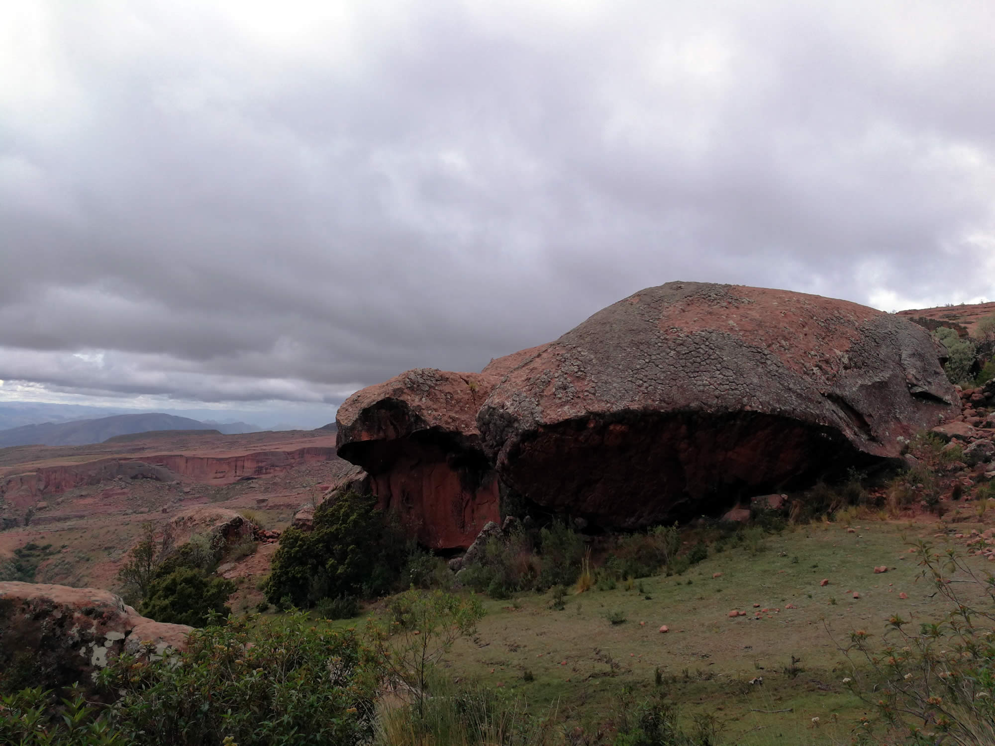
Intermediate geoforms (over 100m) include plateaus, cliffs, terraces, grooves, alluvial fans, etc. While the small ones (less than 100m), resemble real sculptures like those found in Ciudad de Itas, whose blocks made of sandstone seem similar to the buildings of a city, elephants and heads, or in the Mirador de Cóndores, where the carbonate rocks acquire impressive shapes and textures by dissolution.
Finally, the process of erosion are also important geomarks in the Andean heights, where everything is subject to the implacability of gravity
SPELEOLOGY
Torotoro is the largest karstic zone in Bolivia and, due to its geology, geomorphology and climate, there was a formation of a very large variety of caverns ornamented by speleothems (such as stalagmites and stalactites) of rare beauty as well as inhabited by unusual wildlife, such as endemic cave fish. Caverns are complex structures that record the path of water through the fractures of carbonate rocks, as well as rocky collapses that open chambers and galleries, sometimes joined by narrow passages, forming enormous underground networks, some with watercourses and small lagoons.
The National Service of Protected Areas (SERNAP) has 22 caverns registered, Umajalanta being the most extensive and decorated in the country with 4.6 km, and Huayllas the deepest, with 145 m. The caverns are very challenging and for this reason only one of them can be visited by tourists. However, more than 50 caves are still waiting to be studied and explored. Among the most important are Umajalanta, Chiflonqaqa, Yurajq'asa, Huayllas, Chilijusq'u, Huaca-Senca, Chankarani, Chiflonqaqa II, Wayqo Chinkasq'a, Huasarin Railp'a and Puyu Allpa.
ARCHEOLOGY
The Municipality of Torotoro has numerous archaeological sites such as the ruins of human settlements, cave paintings, ceramics, textiles, and bone remains that give us a window into the interpretation of the origins of the human groups that inhabited this region.
In the Torotoro Andean Geopark there is evidence of human presence from the Archaic period (8000-1500 BC), with groups of hunter-gatherers, transitioning to the early regional development of the Formative period and then to the local cultures that had contact and influence from the Tiwanaku culture, and finally the defensive and housing structures of the Late Intermediate period (XIII-XV centuries), in which local cultures belonging to the Charcas confederation (Yampara Culture) and the Caine River Culture stand out. The number of Inca relics found is very limited, and are absent in the two largest sites of Llamachaqui and Inka Corral, probably being under indirect Inca control.
TOURIST DESTINATIONS
Toro Toro Village
Torotoro is an urban settlement that Spanish settlers organized and christened "Indian village" during the second half of the sixteenth century, by order of Viceroy Francisco de Toledo. It was originally endowed with a church, cabildo, guest house and a school, in imitation of its Spanish counterparts.
Torotoro is the second municipal section of the Charcas Province of the department of Potosí located 138 km southwest of the city of Cochabamba.
Torotoro comes from Quechua "thuruthuru", which means "Mud Plain".
To travel to Tortoro is to live an unimaginable experience due to its attractions of scientific interest, its pleasant climate and its circuits full of prehistoric curiosities.
The most important festival in Torotoro is that of the Apostle Santiago - Tata Santiago, celebrated every 25th of July. This festivity exhibits the dance of the "Tinkus", and offers a diversity of clothing, textiles, foods, beliefs and ancestral traditions. The festival integrates the different Quechua communities of the region that organize themselves to make a lavish party and "Tinkus", or fights, as part of ancestral rituals. The party shows a religious syncretism between the belief in the Catholic Saint Santiago and the battles of the "Tinkus" warriors.
Umajalanta Cavern

Umajalanta, located 13 kilometers west of the town, is one of the largest caverns in Bolivia and the most visited by tourists. Umajalanta means "water that is lost in the depths of the earth". When you visit Umajalanta cavern, you will feel that you enter the bowels of the earth.
The cavern of Umajalanta has 7000 meters of route inside, of which currently only 300 meters can be visited. It has a depth of 144 meters and is located at a height of 2850 meters above sea level. The cavern was formed during the Upper Cretaceous.
During the tour it is necessary to do a little physical effort because there are places where it is necessary to crawl through a series of corridors and tunnels that at times shrink and enlarge as you go.
Inside the cavern you will see stalactites and stalagmites that resemble a weeping willow tree, a Christmas tree or a virgin. These spectacular formations result from the precipitation of carbonates from thin films of water that flow through the rocks forming curtains or, by dripping, columns. The attractions not only include the geological samples, but, with a bit of luck, you can get to see the catfish or blind fish (Trichomycterius chaberti sp.) that live in the subterranean waters of the cavern.
ACCESSIBILITY
To access the Cavern of Umajalanta you must take a transport, then walk for about a kilometer passing by dinosaur footprints and beautiful landscapes of Andean life until you reach the headquarters of the association of guides where you can rent a helmet with a flashlight.
The tour lasts approximately 2 hours during which it is necessary to make some physical effort, as there are places where it is necessary to crawl through a series of tunnels that at times shrink and widen as you go. It is best to wear comfortable clothes, slippers and be willing to get dirty.
Chiflonqaqa Cavern

The Chiflonqaqa Cavern is the second most important karst massif inside the Tortoro Park. The cavern is located in the middle of a rocky wall, at the beginning of the Torotoro canyon and the bifurcation of the Fierro Waqykó and Molle Loma rivers.
There are two entrances to the cave: the first is above the waterfall and the second is due to the resurgence of the falling water. In both cases it is necessary to do a little physical effort. For example, in the first entance you need to descend a rather narrow grotto, about three meters high, with the help of a rope; while in the second case it is necessary to submerge in two small pools of water that have a depth of more than one meter.
Once these obstacles have been overcome, the route becomes more enjoyable and interesting. The crossing continues through some passages, which converge at times in small tunnels where it is necessary to drag or make other physical efforts such as climbing or descending and walking through the lagoons. After an hour of travel in the midst of the prevailing darkness, you finally reach a giant room where you can see a variety of very well preserved stalactites and stalagmites. This is the end of the tourist route although it is beleived that the grotto continues. There are indications that this cavern has a connection with Umajalanta.
The journey in the bowels of the Chiflonqaqa Cavern lasts for approximately 3 hours.
The visit to this cavern is still restricted, but it is possible to enter with previous authorization obtained in the offices of the Torotoro National Park.
ACCESSIBILITYBoth entrances require physical effort. For example, in the first entrance you need to descend a fairly narrow cave about three meters high with the help of a rope, while for the second it is necessary to dive into two small pools of water that have a depth of about one meter. During this excursion it is necessary to crawl or make other physical maneuvers such as climbing or descending and walking through lagoons.
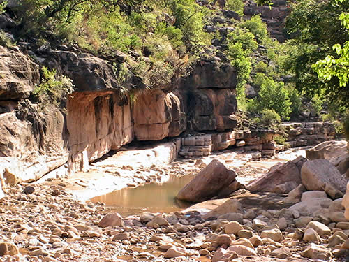
Toro Toro Canyon

The canyon is located in a beautiful natural landscape, has a viewpoint where you can see the different tectonic layers in the profile of the walls that enclose this canyon. These span from the Ordovician, Silurian, Devonian, Carboniferous and Permian periods. However, this canyon is not the only one that exists in the area, as there are others even larger and deeper, such as Laguna and Garrapatal, just to mention some that open in the middle of the synclinal formations of the region.
The Torotoro Canyon has a depth of 300 meters and is one of the most visited. A suspension bridge is planned, so that tourists can go to the other side and also visit the Laguna Canyon located a few kilometers to the northwest.
On the walls of the canyon there are nests of the Red-forehead Parabas (Ara Rubrogenys), an endemic bird in the area that is in danger of extinction.
ACCESSIBILITY
The road to the Torotoro canyon is very easy. The canyon has a lookout with a suspension bridge that allows you to enjoy from the heights the spectacular view of the canyon. This canyon is a detour of the Vergel canyon.
The Canyon is located about 3 km from the town of Torotoro and can be reached by car up to the parking lot of the control post of the protected area. You can take a tour of the Natural Theater and the Stone Bridges or directly follow a small stone path that starts at the parking lot.
The tour does not require any significant physical effort, but it is important to wear comfortable shoes. Please note that visiting El Vergel after this canyon demands a greater physical effort as you will need to descend a lot of stairs.
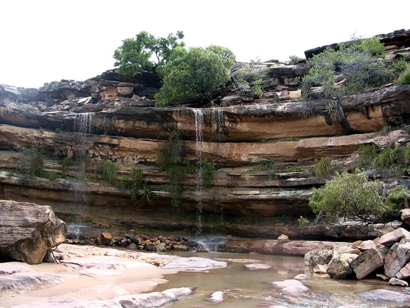
El Vergel

In the interior of the Torotoro Canyon (at a depth of about 300 meters) is the Vergel, also called Waca Singa or cow's nose in Quechua. The Vergel is a beautiful waterfall formed by a mosaic of moss, ferns and the complicity of a curtain of water that falls incessantly and emerges from the subterranean springs that appear mysteriously on the rocky walls of the canyon.
The orchard is formed by slopes and pools of water constituting a delight for visitors. You can take the opportunity to dive into one of its pools of crystal clear water that, by the way, are not very cold. The micro climate of the interior of the canyon is quite temperate. To complement the beautiful green curtain, that no visitor should fail to observe, is the rainbow, which seems to start in one of the pools where the water of the Vergel falls.
The area is low and has a semi-warm climate with an average annual temperature of 27º. In the intermediate zone it is defined as tempered with 24º and the higher zones becomes colder at around 14º.

ACCESSIBILITY
Reaching the waterfall of the Vergel is an adventure. You need to descend 860 steps on a stone stair with wonderful views of the canyon, and then walk about 500 meters crossing over and over again through the water that runs in the middle of the canyon. It is recommended to bring a bathing suit, water to drink, and to go with comfortable shoes. Prepare for an arduous climb on the way back.
Puentes Petreos and the Natural Theater
Walking around the Torotoro canyon you can see two stone bridges formed by the erosion of water and wind. Also, you will observe some rock formations that look like a coliseum.
Near the first bridge there is a place similar to a theater, which in rainy weather becomes a real spectacle thanks to the water that falls like a curtain through the different geological floors.
Meters below, in the continuation of the channel there are tracks belonging to the order of the sauropods and others to the tridactylals. Then later, you can see the second stone bridge, which is much more imposing than the first. From here the river becomes a kind of gorge, whose waters fall in a waterfall to join the canyon of Torotoro, which is about 50 meters ahead.
ACCESSIBILITY
The natural theater and the stone bridges are about 3km from the town following the same road that leads to the Torotoro canyon. You arrive by car and then descend on foot until you reach the Torotoro viewpoint. You can take this tour and then descend to "El Vergel".
Dinosaur footprints

With the discovery of the first footprints in 1968, Torotoro has become the most important paleontological site of the Cretaceous era in Bolivia.
More than 2,500 tracks belonging to the Upper Cretaceous period (between 82 to 65 million years ago) have been discovered, including species such as Titanosaurs, Hadrosaurs, Anchilotaurs, Carnotaurs, Buitreraptors, among others. It is for this reason that Toro Toro has been named the mecca of paleontology in Latin America.
The tracks of dinoraurs have been found all around the National Park. Nevertheless the most representative and intact ones are found just 300 meters from the town on a hill called Wayllas. Here, they left stamped footprints from different species, among them Ankilosaurs, Ceratopsids, Hadrosaurs and Carnotaurs.
Torotoro is undoubtedly a giant paleontological site, since dinosaur footprints were also found in Kúchu Rodeo, Carreras Pampa and on the banks of rivers.
In the Park, considered the smallest in Bolivia (166 km2), there are incalculably rich paleontological deposits. More than ten paleontological zones were found, among them the turtle cemetery of Molle Cancha, which is about 50 million years old.
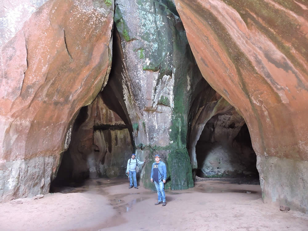
Itas - City of Stone

Located two and a half hours from the town of Torotoro, the City of Itas rises majestically. Locally known as "wacapacana", it is formed by huge rocks that resemble watchtowers.
The set of stone labyrinths that make up innumerable narrow caverns; the existence of a series of eroded rocks, in addition to the presence of cave paintings, make Itas City one of the most interesting tourist attractions in Torotoro.
As we enter this stone metropolis we gradually discover impressive rock formations whose gradual erosion by an ancient sea, rain and wind, came to carve a series of curious formations.
You can also observe abundant Andean fauna (vizcachas, foxes and condors).
ACCESSIBILITY
Itas City is about 21 km from the town of Torotoro at an altitude of 3800 m.s. The excursion consists of approximately two hours of walking and includes descents and ascents through the majestic rock formations.
Turtle Cemetery

Located in the sector of Molle Cancha, 3.5 kilometers east of Torotoro, it is a striking place, as hundreds of fossils of antediluvian turtles, from the Paleogene Period 500 million years ago, are buried in the middle of the reddish sand dunes.
Of these tales of chelonians that are be buried under the promontory of these reddish lands, it is worth mentioning that only about two fossils are permitted for observation by visitors. However, walking through the top or the slopes of the dunes you can find several fragments of shells, vertebrates and other parts of these species.
ACCESSIBILITY
The turtle cemetery is located in the sector of Molle Cancha 3 ½ kilometers east of the town of Torotoro. It has an exposition center that allows you to see fossils of turtles up close.
The Fort of Llamachaki

The Inca fortress of Llamachaqui (foot of flame in Quechua), is 19.5 km from the center of the town of Torotoro and you can only access the site by walking about four hours.
In total there are 23 identified sites; of which four showcase cave paintings.
Of the 23 sites, the pre-Inca fortress of Llama Chaki (foot of flame) is the best known and is the one that is most promoted touristically.
This monumental fortress, located on the crest of an anticlinal hill, contains several individual circular and square foundations of different dimensions, and a great wall that encloses almost the entire perimeter of the crest. The site also revealed many bone and ceramic remains.
Siete Vueltas

Part of the paleontological richness of Torotoro is the existence of hundreds of fossils of the first invertebrate beings that inhabited the marine beaches in the Cambrian period.
In the clay deposits of Siete Vueltas are thousands of fossils of highly complex life forms. These include sponges, corals, squids, worms, molluscs, crustaseans.
In fact, all the main classifications of invertebrate life forms of the Cambrian have been found in the rocks.
This variety of fossils also exists in other places of the municipality, but they have not yet been enabled to be visited by tourists.
Crossing this valley allows the traveler to make an indescribable trip in time, from the Cretaceous to the Ordovician. The first pages or strata are whitish calcareous that originated in the sea of the Upper Cretaceous, 100 million years ago. Later, they are followed by strata of reddish sandstones from the Lower Cretaceous period. At the same time that you enjoy the beautiful scenery, you are "flicking through the pages" of the strata of the Permian. Originating on the shore of the supercontinent of Gondwana, more than 300 million years ago, the fossils of marine life are of rare beauty and great scientific importance. The road continues until the traveler reaches the strata of the deep Devonian and Ordovician, 450 million years ago and is impressed with the fossils of an ancient time.
ACCESSIBILITY
Siete Vueltas is only 1 km from the town of Torotoro, and can be reached by car or on foot. It is a steep hike that allows you to travel through time, as well as glimpse a scenery of great beauty.
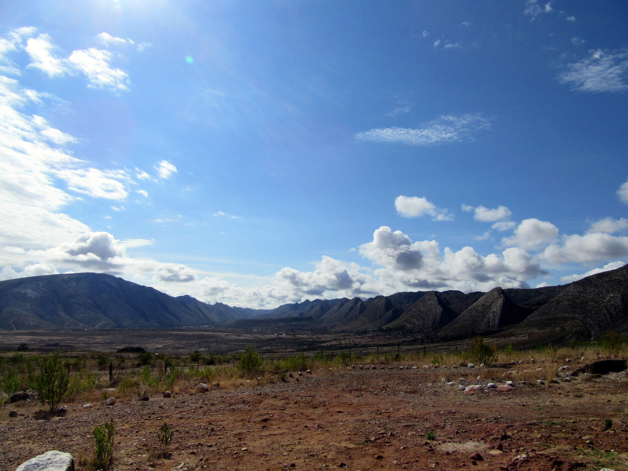
Torotoro Syncline
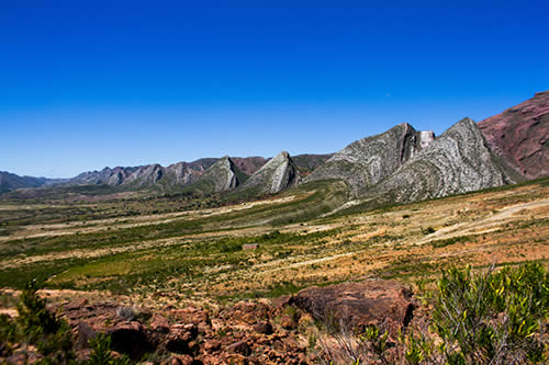
The Andean mountains are unique in the world. They originate from the clash of the Nazca Plate (part of the floor of the Pacific Ocean) with the western edge of the South American Plate. This process began intensively almost 20 million years ago and resulted in a compression and elevation of what was the carbonate bed of the Cretaceous Sea. The Eastern Andes are the record of this contraction through great faults of thrust and folds of the synclinal type. Evidence of this unique Andean tectonics in today's world is the beautiful Torotoro syncline. The fold is shaped like a gigantic gutter that is 45 km long and 10 km wide, whose lateral flanks are made up of white calcareous rocks. The subsequent processes of erosion of the almost vertical western flank resulted in an aligned succession of triangular shaped hills (hogback type) that look like gigantic teeth and whose valleys are called "Q'asas" in Quechua.
ACCESSIBILITY
This geomorphological formation of rare beauty can be seen from the entrance of the town as well as from several places in Torotoro. However, the best place to appreciate the sequence of these teeth (and their Q'asas) is from Huayra Q'asa, where the Umajalanta Cabins Hotel is currently located.
Huayllas Hill
Among the innumerable tracks of existing dinosaurs, those found in the rocky outcrops of the foothills of Cerro Huayllas, located on one side of the Torotoro River and near the town, constitute the largest paleontological icon of Torotoro.
Found in 1981 by Giuseppe Leonardi, the tracks on this hill constitute the first tracks described in Bolivia and the longest found in Torotoro. The footprints belong to a quadruped gait of sauropods. Also, in the area you can see other tracks belonging to the species of Ankylosaurs, Ceratopsids, Hadrasaurs and Carnosaurs.
The imprints that are found in this sector show that Torotoro, during the Cretaceous period, was a sea. The dinosaurs roamed on the shores of this sea, and for this reason in several sectors around the town, as well as in the entrance to the caverns and the canyon, you can find such remains.
ACCESSIBILITY: Huayllas is located at the entrance to the town of Torotoro and can be visited on foot from the town. It is a light walk to the footprints left by the passage of the giant sauropods.
Carreras Pampa
Other significant tracks within the reach of the public are the three-dimensional tracks belonging to the carnivorous velociraptors found on the road to the Umajalanta cavern. Popularly known as Carreras Pampa, the name comes from the fact that by analyzing the well-preserved tracks, it can be concluded that these species were running, probably behind their prey. Among the species identified there are Coelurosaurs, Hadrosaurs and Carnosaurs, whose footsteps also can be located in other sectors of Torotoro.
ACCESSIBILITY: Carreras pampa is on the way to the cavern of Umajalanta, approximately 5 km from the town. You can get there by car.
Batea Qhocha
Batea Qhocha are natural pools located at the continuation of the Torotoro River, about 200 meters before reaching the cavern of Chiflón qaqa.
With its turquoise waters, Batea Qhocha is a beautiful scene where the stones were carved by the river. Innumerable waterfalls are found at each step and in each river that flows into the Torotoro canyon.
ACCESSIBILITY: Batea Qhocha is reached by taking a walk of about half an hour. There is no access for cars. It is important to take into account that one can bathe in pools only during the rainy season (October to March).
PLAN YOUR JOURNEY TO TOROTORO
When to travel to Torotoro?
The Torotoro National Park can be visited throughout the year. The dry season (April - October) is more temperate and with little chance of rain. Although the landscape is a bit more dry and arid, the climate favors access to all attractions.
During the rainy season (November - March), the landscape becomes greener and you can better enjoy the waterfalls of the canyons. There may be rainy days when no entry to the caves is allowed for security reasons
Duration of your stay - Description of the main tourist circuits of the Torotoro National Park and time required for each visit
The Torotoro National Park offers various attractions that are within a radius of up to 30 km away from the town. In two full days you can visit two of the main routes, if you want to know more about the wonderful attractions we recommend to schedule 3 to 4 days.
Below is a brief description of the main tourist circuits of the Torotoro National Park where we indicate the time required for each visit:
Circuit 1: City of Itas
Duration of the tour: 4 - 5 Hours
The city of Itas is 21 km to the west of the town of Torotoro, which is about one hour's journey by vehicle. It has an altitude of 3700 m.s.n.m.
You will see majestic formations of open natural caves in sandstone in the form of tunnels, stone labyrinths and giant tower-shaped rocks, which were formed naturally and give the impression of a citadel.
During the tour you will also see cave paintings and wild animals such as vizcachas and birds.
Sites of interest:
- Stone Towers
- Lagoons
- Waka Pakana
- Itas Cathedral
Circuit 2: Umajalanta Cavern
Duration of the tour: 4 - 5 Hours
Umajalanta Cavern is located 10 km. west from Torotoro town, about 20 minutes away by car at an altitude of 2850 m.s.n.m..
You can see some dinosaur tracks located on the way to enter the cave.
In the interior of Umajalanta you will find dazzling formations of stalactites and stalacmites in different sizes, as well as an underground river inhabited by an endemic species of blind fish.
Sites of interest:
- Concert Hall
- Stalacmite La Virgen
- Weeping Willow Stalactite
Circuit 3: Dinosaur footprints, Torotoro canyon and El Vergel waterfall
Duration of the route: 4 - 5 Hours
This circuit is located 4 km. to the north of the town of Torotoro, at an altitude of 2800 meters.
During the tour you will see petrified tracks of different families of herbivorous and carnivorous dinosaurs. You will also see the geological strata of the Cretaceous Sea, a natural stone theater, stone bridges, the great Torotoro Canyon, the viewpoint, the El Vergel waterfall and crystalline pools located inside the Torotoro canyon.
You will also observe a variety of red-forehead birds and parabas.
Sites of interest:
- Dinosaur footprints
- El Vergel waterfall
- Torotoro canyon
Circuit 4: Chiflón Qaqa, Valley of Mushrooms and Dinosaur Footprints
Duration of the route: 4 - 5 Hours
Located to the northwest of the town of Torotoro at an altitude of 2800 m.s.n.m.
During the tour you will see cave paintings located inside one of the canyons, natural pools, a waterfall that springs from a cavern in the middle of the Torotoro canyon, rocks in the form of mushrooms, fossils of small marine organisms and the best tracks of carnivorous dinosaurs in the region.
Sites of interest:
- Valley of Mushrooms
- Chiflon Qaqa Waterfall
- Cave paintings
Circuit 5: Siete Vueltas
Duration of the route: 3 - 4 Hours
Siete Vueltas is located 3.5 km southeast of the town of Torotoro, at an altitude of 3100 ms.n.m.
The trip to Siete vueltas includes a walk through a precolonial path that has more than 7 curves in a mountain, also several geological strata and fossils of marine species belonging to the Cretaceous period - Mesozoic and the Permian - Paleozoic; which evidences the existence of a seabed millions of years ago
Sites of interest:
- Anticlinal hill
- Marine Fossils
- Views of the town of Torotoro
Circuit 6: Llama Chaqui
Duration: 12 hours. All day. It is recommended to start the tour at 06:00 a.m.
The fortress of Llma Chaqui is located 19 km. East of the town of Torotoro. There are two canyons nearby. It is considered a pre-Inca fortress due to the archaeological remains found in the place: Tombs- Chullpas, walls, ceramics. Llama Chaqui is considered the main archaeological site of Torotoro.
There is a cavern of bats, dinosaur footprints and petrified llama footprints.
Sites of interest:
- Ruins of Llama Chaqui
- Tombs - Chullpas
- Landscape
Circuit 7: Turtle Cemetery
Duration: 3 - 4 hours
The Turtle Cemetery is located 3.5 km southwest of the town of Torotoro, where you can see fossils of turtle shells, some fragmented fossils of fish, crocodiles and other unidentified species belonging to the Cenozoic era.
You can see the reddish earth and visit the Paleontological Museum
How to get to Torotoro?
The Torotoro National Park is located in the northeast of the department of Potosí. The main and only viable access to the population of Torotoro is through the city of Cochabamba. It can be reached by private car, bus, minibus or plane. The trip by land can be made through Tarata (or Cliza), passing through Huayculli, Anzaldo and Thayapaya. The trip takes 4-5 hours by land and 30 minutes by plane.
Torotoro does not have a service station. The nearest gas station is 99 km away in the town of Tarata. You can get gasoline in bulk at some stores in the town at a higher cost. If you are driving in a private car, it is important to get the necessary gasoline in advance.
TRANSPORTATION SERVICE
Buses:
Departures: Cochabamba - Torotoro
Thursday, Sunday: 06:00
Monday, Tuesday, Wednesday, Friday, Saturday and Sunday: 18:00
Torotoro - Cochabamba Exits
Monday, Tuesday, Wednesday, Friday and Saturday 06:00
Friday 18:00
Sunday 14:30
Bus Stop in Cochabamba: End Av. Republica almost Av. Barrientos
Departures: Cochabamba - Torotoro
Every day: When it is full (7 passengers per minibus)
Minibuses stop in Cochabamba Av. Republica almost Barrientos
Minibuses
Admission to the Park and Guides
There are costs of access to the park and for hiring guides. The park can only be accessed with an authorized guide. Children can enter from age 10. Children under 10 years of age may enter under full responsibility of the parents. The offices of the park and the Association of Guides is located on Calle del Olvido.
The costs are as follows:
Admission to the Park:
- Children (10 - 12 years old): Bs. 20 / $ 3
- Students: Bs. 20 / $ 3
- National Adults: Bs. 40 / $ 5.80
- International adults: Bs. 100 / $ 14.50
Guide Service (Cost for groups of 1 - 6 people):
- Nationals: Bs. 80 / $ 11.50
- InternationalsBs. 100 / $ 14.50
Transportation service to attractions: (if you do not have private transportation)
- City of Itas: Bs. 150 / $ 21.50
- City of Itas and Umajalanta cave: Bs. 330 / $ 47.50
What to pack for your visit to Torotoro?
It is necessary to wear comfortable shoes, sunscreen and warm clothes. Do not forget to pack a hat and mosquito repellent.
For your visit to the cave of Umajalanta it is necessary to bring clothes to be dragged on the ground, preferably long pants, comfortable shoes and water.
Banking Services
Torotoro does not have a bank or ATM service. Therefore it is very important that you plan your expenses and bring the necessary amount in cash. Apart from the costs of lodging, entrance to the park, transport and food, you may need cash to buy the beautiful crafts of the place.
Rate this article
Rating: 2.6 , 11 votes.
Recommended Tours:

Toro Toro Umajalanta Classic, 2 Days, 1 Night
Toro Toro Umajalanta Adventure, 2 Days, 1 Night
Toro Toro Land of Dinosaurs Private Tour, 3 Days, 2 Nights

Torotoro Umajalanta Cabins, 3 Days, 2 Nights

Torotoro Umajalanta Cabins Light, 3 Days, 2 Nights
Torotoro Umajalanta Complete, 4 Days, 3 Nights
Bolivia Travel Expert
Bolivia Travel Information
MOST WANTED
Contact Vivian, our chief Bolivia Travel Expert
Send us some details so we can start creating your tailor-made trip. Or if you would like to speak to us directly, call us via Skype or Whatsapp.